Echo Mountain
Mountain peak · Los Angeles County ·

Echo Mountain

Mountain peak · Los Angeles County ·

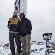
Views of ruins, echo phone, and LA basin vistas

hiking trail
echo mountain
sam merrill trail
views
incline
ruins
history
workout
Echo Mountain by null

Information

California 91001 Get directions

Information

Static Map

California 91001 Get directions

localhikes.com

Features

Last updated

Jan 14, 2026

Powered By

You might also like

Terms of Use • Privacy Policy • Cookie Policy
 © 2026 Postcard Technologies, Inc.
@afar
25,132 Postcards · 3,701 Cities

"A Bit of Local History Echo Mountain has a great deal to offer, from the switchback trail, which will give you a great workout on your way up the mountain (start early to avoid the blistering afternoon sun), to the views—on a clear day you can look out over Pasadena, Los Angeles , Santa Monica, and all the way to the Pacific. Next, there's the history. Take time to explore the ruins of the old resort and railway—small plaques post intriguing details and old photographs of what life was like for visitors on Echo Mountain (before it was destroyed by fires and mudslides). Trail access begins at the north end of Lake Avenue at the Cobb Estate Gate. Take lots of water, a picnic, and do be sure to give a good holler through the "Echo Phone" while you're there."

Wood grain pattern
L.A. Day Trip: Pasadena
Echo Mountain
@afar
25,132 Postcards · 3,701 Cities

"A Bit of Local History Echo Mountain has a great deal to offer, from the switchback trail, which will give you a great workout on your way up the mountain (start early to avoid the blistering afternoon sun), to the views—on a clear day you can look out over Pasadena, Los Angeles , Santa Monica, and all the way to the Pacific. Next, there's the history. Take time to explore the ruins of the old resort and railway—small plaques post intriguing details and old photographs of what life was like for visitors on Echo Mountain (before it was destroyed by fires and mudslides). Trail access begins at the north end of Lake Avenue at the Cobb Estate Gate. Take lots of water, a picnic, and do be sure to give a good holler through the "Echo Phone" while you're there."

Hiking LA
Echo Mountain

Sharon G.

Google
Cosmic GRID POWERED Safe And Sound. PROTECTED AREA CODE 🧬🛸✔️ WOMB TO TOMB STURDY STURDY sturdy stur...

Queenie H.

Google
this hiking route is really good if you want higher elevation hikings, if your an intermediate to expert in hiking ur gonna love this place for its distance and steepness, also no reservations are needed

Nicholas R.

Google
This was a moderate hike, 5 miles, i spent 5 hours doing this half day hike. Bring plenty of water, be alert, the trail is very narrow. No restrooms and no parking lot for the trail, but you can park in the residential area but be careful not to get a parking ticket from law enforcement. And i went on a Saturday, it was very packed with other hikers.

Alix S.

Google
Beautiful trails!! Burn area from the early 2000 fire is here, amazing views at inspiration point

Miercat

Google
About a 6 mile hike. Not an easy hike, but the view is amazing

Emill S.

Google
These are ruins at the end of a hiking trail and it's not an actual resort. But the place is wonderful and there is a yodeling burn horn. I think if you are a hiker, you will enjoy this. If you're not a hiker, be warned, it's not a quick trip to reach this place.

Kristina H.

Google
Absolutely love this hike. If your up for something more challenging this is for you. It’s hiking at an incline with switchbacks. The trail also branches off into other trails so you choose the distance. Pack water and if you doing one of the longer ones I would recommend packing a lunch😀

Nathan JJ S.

Google
went here mid-afternoon on a tuesday, there was almost no one on the trail. there are two ways up I believe, and I took the less popular route which begins at the mount lowe road trailhead. it took me about 80 minutes or so to reach the top of echo mountain. the signage is really clear, the trail is nice and wooded; winding on the side of a canyon, it steadily climbs uphill. you can hear water, too. what's especially cool is that the trail goes near some old cabins, an old mine, and generally follows the pathway of a defunct railway line. all along, there are some really nice panoramas of altadena, pasadena, and greater los angeles. the trail terminates where the rail line does, and it was fun to explore the ruins of the resort town that they built at the top during the 1880s. one of my favorite LA-area spots -- really cool nature combined with some really cool history!
google avatar

Esther T.

Yelp
Had so much fun hiking here with my bsf. Arrived at 5:40 AM and finished right before noon. In my opinion, the trail was a little difficult (physically) because of how steep it is on the way down, though, it was worth the knee discomfort lol.
google avatar

Cindy C.

Yelp
This is my favorite hiking spot. Parking is free and easy to find unlike some other hikes. The 2.5 miles to the railroad is all a small narrow incline. I would recommend wearing hiking shoes and not nmds like me. I felt every rock and almost slipped but it was all i had. I always feel accomplished after this hike and i love seeing the Gumby rock at the top.
google avatar

Travis P.

Yelp
This is such a great trail with a moderate difficulty. About 3 miles up with a winding incline route. It's not super scenic until you get to the top which you are greeted with historical objects and other cool things. They have an echo phone at the top which creates an insane echo that can be heard after two seconds. Will take my other friends!
google avatar

Antoine W.

Yelp
This by far one of my favorite local hiking trails. It will definitely test your resolve with unrelenting inclines that will have you gasping for air. Once I conquered the ascent, I was rewarded with jaw-dropping views that made the struggle worth it. Pro tip: go early, like 6am to avoid the crowds, bring extra water, a sense of adventure, and a reminder that you're doing this because you are in California and this what Californians do. IYKYK!! Five stars for the scenery, and fresh air. Oh yeah when you see Gumby your almost there.
google avatar

Tony H.

Yelp
The hike up to Echo Mountain is 5 + miles round trip starting from the Cobb Estate entrance to the Sam Merrill trail. It's a bit of a steady climb the entire way up with almost 1,500 feet of elevation gained. Once you get through the Cobb Estate and onto the Sam Merrill trail the path is fairly easy to follow up to Echo Mountain, there are a few narrow parts of the trail as you're going up and once you're going up there isn't much shade so make sure you have a hat and sunscreen during those bright sunny days. When you get near Echo Mountain you'll see a few different trails that lead to Mt. Lowe, and Inspiration point and those spots also lead to other locations in the mountain. Overall the Echo Mountain hike is a pretty good workout with some interesting history about the area from the early 1900s with a other trails that you can explore from there.
google avatar

Carl N.

Yelp
What a better way to start the new year (2022) by hiking mother nature. So without further ado let's begin this hiking trail review. Sam Merrill Trail is a major trail in Altadena which leads to Echo Mountain. It's a well-engineered and well maintained. There are few points where the trail has been shored up with boards, creating a steep drop if you were to step off the trail. Keep your eyes on the trail and you'll be fine. Hikers will enter through Cobb Estate gate on Lake Avenue to get into the trail and it's strictly street parking only. The degree of difficulty is moderate to hard because the trail ascends at a steady aggressive grade, but never gets too steep over the 1,400-foot climb. Sam Merrill Trail is a rewarding experience, rich with history. After a 1 1/2 hours (7,271 steps) of hiking I reached the White City, a ruined resort complex, where I explored and spent most of my time. It was a pretty ruin and the view was amazing albeit mostly covered by clouds. My hiking distance was 5.8 miles and it took me 3 hours (out and back) at 3,200 feet of elevation. I descended down the trail during sunset. And it was glorious! I like how the sun hits the sedimentary rocks which gave a glowing gold (see photo) color. Overall, I enjoyed this well kept trail and it's rich history. I highly recommend Sam Merrill Trail.
google avatar

Tony L.

Yelp
If you're looking for a challenging hike or like pain look no further! This is NOT a beginner hike and not even intermediate. Yes you have been warned! If you're not in shape, have any walking issues do not even attempt this hike. First off parking is street only along the neighbor hood on Lake Ave or Loma Alta Dr. No adventure pass is required and free. The entrance to the trailhead is through the metal gates with the sign Cobb Estate Trailhead. You'll walk up a sidewalk about 500ft till you reach the actual trailhead. It's marked by this concrete water fountain thing. No there are no written signs. You need to go on the right side path to go on the echo mountain trail. If you go left it will be a completely different trail! Note this trail is very heavily trafficked with very narrow paths along the cliffside. If you have trekking poles you may wanna use them here! This particular trail is 5.4mi round trip. The first leg is 2.5mi all uphill with 8% grade up to final 3200ft elevation. You'll absolutely feel the burn in your legs! If you go early, around 8am your first mile will at least be in the shade side of the mountain too. Again the path is very narrow so be careful of slipping off! Share the path with people coming down too. There are a few benches along the trail to sit and catch your breath or just to enjoy the views. You can clearly see the entire SGV all the way to DTLA in the horizon. At the first peak you'll reach a crossroad. You either can go right to the Mount Lowe Railway viewpoint or continue left for to inspirational loop point. Note inspirational loop is another 4 mi to that summit. The Mount Lowe Railway viewpoint is where majority of people go if you made it this far. It's the site of the historical Echo Mountain House and Mount Lowe Railway. You again get a beautiful view of the valley from here. This would probably a great spot for July 4th fireworks if you get up here! Note there are no bathrooms or water anywhere on this trail so prepare your own supplies! Just remember its all downhill on the way down so if you got knee issues wear your knee braces!
google avatar

Hannah S.

Yelp
Fantastic hike - heck of a workout for sure! Sadly we didn't make it all the way up to Inspiration Point bc we got confused and didn't realize how much further up it is from this particular trail...and it's not mentioned in AllTrails info - it's listed as a separate hike! All told - from our car and back and bc we explored extra bc we got a little lost - we hiked just over 6.5 miles, 1700+ elevation gain and did just over 22,400 steps - took us about 4 hours. This particular trail is about 2 3/4 miles up one way (so 5.4 miles out and back) - you start at the trailhead at the old Cobb Estates area at the top of Lake Ave. It's a steady incline all the way up with lots of switchbacks and was manageable- I'd call this hike moderate to lower level advanced - definitely not a beginners hike. We gained 1700+ feet in elevation and the trail is very very narrow and can be very rocky in places with tall steps. We got there right around 8-810am on a weekday and it was pretty crowded - and also had some mountain bikers which makes for a very interesting situation passing each other on the narrow trails lol! But it makes for a fantastically exhilarating adventure! You're treated with absolutely gorgeous views of the LA Basin and downtown and we were even able to see all the way out to Catalina island! There were a couple of small benches and one large one on the way. And at the top there are fascinating ruins of the Echo Mountain House (an old Victorian lodge) and the Mt Lowe Railway - there are hug cogs and wheels left and some tracks that go right off the mountain! There are also lots of information plaques telling of the interesting history. I loved it! I realized too late that we totally missed the echo phone in the upper part where some picnic tables are - but I'll be going back once I work up to being able to get to Inspiration Point. Turns out, Inspiration Point is up another trail once you get to the ruins - and it's about another 2 miles up (4 miles total loop) - so if you do the whole hike, you're looking at just over 10 miles. We got just a tad lost trying to find it bc the signs aren't obvious- but if we had planned better it wouldn't have been an issue. Lesson learned - part of exploration and adventuring!! Parking is all street parking at the end of Lake Ave and is a residential area. We didn't have any issues finding a spot. But be sure to read the parking signs for any restrictions since this is LA. There are no bathrooms or facilities so be prepared. Bring plenty of water! We needed our packs, snacks, water, hiking shoes and poles for this one!
google avatar

Ed T.

Yelp
This was a surprising hike because of the history at the end of the trail. There were some remnants of a railway and a huge cog at the top. Total round trip was about ~5.5 miles that took a little over 2.5 hours. I went on a Monday afternoon so it wasn't too packed. The trail was a steady incline on a narrow dirt path. You will be expected to stop to let others pass. The weather was gloomy these days and it was foggy at higher elevation. Therefore, you won't get any views at the top which was okay. Parking was free and on the side of the streets. It was kind of eerie up there but still a fun hike. lol
google avatar

Natalie S.

Yelp
Ready to sweat and give your legs a workout after Zooming all week?!? Get yourself to this Altadena trail! Street parking is relatively easy and free ~ it does get busy though so come either really early or later in the afternoon. I prefer to catch the sunset at the top of Echo Mountain. The views of LA and occasionally, on a clear day, even ocean views all the way to Catalina, are breathtakingly beautiful! The trail itself gets very narrow at times which makes it a bit of a pain if there are lots of people, but overall you can hike and remain socially distant. Thankfully, most people on this trail wear face masks so you can feel safe. It is also a sun exposed trail which is why I think that either an early morning hike or late afternoon hike is preferable. I find this trail to be a fun, moderately challenging hike to the summit and once you get to the top you are rewarded with a very cool historical site (the ruins of the burned Echo Mountain hotel - built in the late 1800's by Thaddeus Lowe. There were no roads to this hotel -- you reached it via an incline railway that climbed over 1,000 feet!). It takes me about an two and a half hours to complete the full 5.8 miles and it is SO worth it! One of my favorite SoCal hikes!
google avatar

Alique B.

Yelp
This is an awesome trail!!! Will definitely come back. Parking was difficult but it was worth the struggle. The trail is pretty easy but it's described as moderate. I love that there are so many different trails you can take depending on how long you want to hike. Views are nice and the trail is clean. No shade though.
google avatar

Steven B.

Yelp
From the gate entry at Lake & Loma Alta, it took us 1hr 15min to get to top of Echo mountain. Good hike all the way up once you hit actual trail.
google avatar

Lexi K.

Yelp
First of all.. the All Trails app says this trail is 5.4 miles round trip. So in my mind I was thinking "ehh... shouldn't be too bad since it's 2.7 miles in and 2.7 miles out." The entrance is located at the Cobb Estate gates. I remember coming here before at night time when I looked up "Enchanted Forest" or "Haunted Forest" hike. At night time, it's actually scary AF when you can't see anything and every moving bush will scare tf out of you! I never finished the night hike but I'm glad I returned to complete the hike in the day time. Mind you, 2.7 miles doesn't seem like a lot until you have lots of inclines to endure. Over this COVID period, I have not been physically active so my stamina has dropped drastically. Not even half way up, I was already dreading to complete the hike. Very often I thought I had reached the top but when you get to the towers, you're probably 1/2 way there. I was eager to know how much longer I had to get up there and I kept asking everyone who was coming down, "how far or how much longer is it to get to the top?" Most people would tell me 30 more minutes and it made the experience even more dreadful. I am not one to quit so I took every opportunity I had to chill under the shade. Definitely go early in the AM to avoid the heat. I was also dehydrated as well so that does not justify how "out of shape" I am. LOL I brought my two dogs with me and trust me... you may need to carry them all the way down as they get exhausted from all that incline walking up hill. Make sure to bring lots of water for yourself and your companions as well. Once you get to the top, you'll find historical pieces that were left from the old railway. Definitely worth the hike up with an amazing view of the city and you'll also see the ocean from up there too! (Only if the sky is clear enough) - Go after the rain! BEST TIME! TRUSTTTTT!!!
google avatar

Jason G.

Yelp
This is a great trail for hiking and well work the time and effort for the views and serenity of being outdoors. It's not too strenuous either.
google avatar

Magdalena T.

Yelp
Loved this trail! All the historical tidbits made it more enjoyable, interesting read, and the incline wasn't too bad with good and comfortable shoes. We encountered some lizards and a harmless baby snake along the way going up the bush, so definitely be careful, but overall it wasn't too bad at all. Pretty cool to shout in the echo phone to hear back and there's a loud echoing pipe that might be more fun to go with friends to sing at
google avatar

Justin T.

Yelp
Great intermediate hike for anyone in the area. Good for dogs but require leashes. Parking is at the bottom of the hike and is on the street. The hike itself is about 4-5 miles in total. It's an uphill climb initially and the path itself is not that wide so you might have to wait to let other people pass and probably better to mask up as well since everyone isn't that spaced apart. It's a lot of hatchbacks up the mountainside. There is a fair amount of shade but I also went on a foggy morning so not sure if it was adequate would recommend sunscreen though. At the first destination there is a ruins of a hotel that used to be there and large gears that where left behind. There is a lot a picnic area if you want to bring up food. I am not a super experienced hiker but thought it was a good workout and jist brought a 1L bottle of water and a small snack and was good for the hike. The top of the hike has a nice overview of LA and there are a lot of great spots to take nice pictures. There are more trails further from this and I thin you can also go to inspiration point as well! I didn't bring walking sticks and I was fine! Will definitely be back!
google avatar

Mel C.

Yelp
Echo Mountain via the Sam Merrill Trail (Altadena, CA) Stats from AllTrails 5.4 miles RT 1,417 ft. Elevation Gain AllTrails describes this hike as a moderate and heavily trafficked out and back trail. No kidding! This hike is very popular, and my recommendation is to start early if want to avoid the crowds and find parking. Keep in mind that the hike from the trailhead to the top and back down is 5.4 miles. We parked a few blocks from the trailhead. So, our total distance from our car and back was a little over 6 miles. AllTrails has this hike listed as moderate, probably due to the total distance and elevation gain. In my opinion, the hike did not feel too long and the trail to the top was so gradual that I didn't even feel like I was climbing up a mountain. The trail is narrow so be careful. There are plenty of hikers on this trail and all walks of life. Just remember hiking etiquette...hikers going uphill have the right of way. The reward is at the top. The views of Los Angeles are sweet. But it's the history of Echo Mountain that makes this hike worth it. Ruins of "White City" remain at the top, including the foundation and some parts of the railway. There is plenty of room at the top to rest, grab a bite, hydrate, and social distance. The hike down is easy but should not be taken for granted due to the narrow trail. Remember, you are still on a mountain and gravity usually wins. Enjoy!!
google avatar

Terri C.

Yelp
We did this moderate hike last month on a lovely Sunday morning. This is a combination of two trails, the Lower Sam Merrill Trail and the Mount Lowe Railway Trail and will take you about 5.5 miles round trip. While hiking up the switchbacks through the Las Flores Canyon, not only will you get terrific views of Los Angeles, but you'll also encounter bits of history. Remnants of the Echo Mountain House and Mt. Lowe Railway are cool to see up close. I had never heard of the "White City in the Sky," a popular resort in the late 1890s and apparently was briefly the most visited honeymoon destination in the U.S. The sweeping views of the city and the history surrounding this hike make for a very nice trek.
google avatar

Regis K.

Yelp
One of the great trails for hiking in the San Gabriel Valley. This is the only hiking trail does not require reservation during the pandemic. It's a beautiful trial with easy to medium difficulty. Getting there is easy. Just get off on lake from 210 freeway and go all the way north to the end of lake Ave. There is a small entrance gate to the trail. The path to the top is right straight from the gate across the dried up stream to the starting point of the trail. The trail is about 2.5 miles to the top. On top, there is the inspiration point where you can see the whole of LA. On a clear day , you can even see Catalina island. While on the top of the trail, you can see the remains of the train gears where there used to be a train hauling passengers up to this top to a hotel here. Even though the hike is relatively easy, you do need a good shoe for hiking as the road is not even. Please do bring a mask to the hike. Parking is along the street and don't have a lot of spots. If you can, carpool with someone.
google avatar

Joshua L.

Yelp
Truly one for the gluteus maximus. It's a slow and steady incline towards the top. The trail is pretty narrow, so I suggest wearing a mask. And considering everyone's going hiking nowadays, it was pretty crowded, but nothing that wasn't manageable. It took us about 2.5 hours. You're in the sun for a good portion of it, so I suggest you should pack a nice lil bag of snacks/water. Peak: not the greatest peak I've seen, but a good one for LA, especially because you can see the entire city from the top. The peak used to be a hotel that burned down - there are signs for "tennis courts" and picnic areas. I don't recommend sitting down to eat during COVID as plenty of people are going in and out, but there are good places to stop and appreciate the "history" and nature. Parking: parking makes the most sense on E Loma Alta Dr - but since that was filled up when we got there, we found a good spot on N Morengo Ave.
google avatar

Megan R.

Yelp
Need to come back with a hiking buddy! Went for a little solo hike here last week and though I'd been a few (well, maybe five) years ago, it felt new to me. Parking is easy at the top of Lake, just be sure to stay on the main roads rather than getting into the neighborhoods as those look restricted. Once you get past the main entrance (which is a mix of dirt and concrete), there's a trail directly to your left or another one that's straight ahead and then curves left. I gave both a try but ended up doing the first turn left since I was alone and it seemed like less of a ledge. That hike was fairly short and easy with a few places to stop and rest in the shade should you need it. There was some graffiti and I saw one coffee cup, but otherwise the trail was pretty and clean. We had a really rainy spring so everything is really grown, and a fear of snakes totally came over me while I was there! Would love to try the longer, more challenging hike sometime soon when I'm not alone. Will surely dig into the tips and tricks via the reviews on this page. Thanks, hikers!
google avatar

Abou K.

Yelp
If you're looking for a challenging hike with an incredible reward at the top, plus a great view for lunch, this is the one for you. I ended up going on this hike by myself during one of my off days, but I totally feel like its more of a group hike. It's challenging but easy enough that you could enjoy conversation with others while doing it. But the best part is when you get to the top and see the amazing view, there're plenty of tables to share a meal with each other. Nothing like lunch with a view. Plus there are multiple lookout points on the way to the top! It is a pretty popular trail so I would recommend doing it either very early or on a weekday to avoid the rush of folks. Not to mention the trail is dog friendly. You can't beat it!
google avatar

Emily L.

Yelp
o4.19.19 I used to hike a lot and I really wanted to get back on track. And this day was a start. It was so great to hike one of my favorite trails on a day off. The weather was absolute perfect. And honestly, the big well looks different each time I go. There were so graffiti now. It's nice yet I don't think it should be there. Esp when some ppl wrote cussed words. That was terrible. But regardless, it was a great workout!
google avatar

Alex K.

Yelp
One of the MANY trails offered throughout the city. First timer here after a referral from a friends. About 40 minutes outside Los Angeles in Altadena. There's plenty of parking along the residential street. The residents are either used to it or hate that people park along the streets. But there's plenty of parking. First off, I did not know that it's known to be haunted. Another first for me hearing it from a friend. Before the trail starts, there's picnic areas to lounge. I had 2 slight detours along the way.... More to come. There was a group of us that was hiking today. I waited for a friend who wasn't here yet so the group started ahead. When we finally started the hike, we just continued on the main road as it seemed like it was a path. Going about half a mile up, we could hear our group of friends yelling down to us as they were already ahead. Your going the wrong way.... Lol, well that wasn't a great start. Had to walk all the way back down to finally get on the trail that they were on. The trail starts off nears residential properties then starts the incline up. The path isn't wide and some parts are very narrow so you have to be careful. Your basically incline up the whole way. But zig zag along the trail. There's a couple of benches scattered for the scenic view or resting. As well as markers letting your know when you reach each mile. This trail was about 2.5 miles up so 5 miles round trip. Slightly more for me as I had that 2 detour. Certain parts of the trail is narrow so be careful. Also, when passing someone, you would need to move to side and let that person move along. It's not really made for waking next to each other. We did it in the late afternoon so the sun was a bitch. Along the trails, some parts was pretty cool walking through like an enchanted forest with the trees above you. The view of the city was amazing as well. Once you reach the top area, there's a sigh that tells you where the echo phone is to the right and the echo Mountain to the left. I ended going left on another trail that lead me to an extra mile the wrong way and then having to make my way back. My fault.... Back at the echo phone is where the old Echo Mountain House Hotel use to be. The property isn't there anymore but reminiscent of the hotel still preside there. There's a couple sets of stairs that take you to the top where the views are amazing. Towards the back of the property is where the echo phone is. Your able to talk through it and hear your echo. I mean, with everything Covid, I gave it a miss. Also, there's a lot of picnic tables around the area. Great little spot for food after your hike. By the time I made it there after the detours, it was sunset. Amazing as always. But heading back down it starting getting dark. I recommend bring a flashlight with you Incase it gets dark cause it can be dangerous with the narrow trails. We did run into some hikers that were barely starting as they had flashlights headpiece. I'm assuming they're there for the haunted experience. Overall experience was great. I highly recommend this trail. It's moderate as it is incline the whole way and can be narrow. If your afraid of heights, go at your own discretion. Make sure to have water as the sun is a bitch during the day. Being a flashlights case it gets dark. If you're up for carrying a bag, pack a lunch and enjoy it at the top with the view.
google avatar

Evalyn P.

Yelp
This trail goes alllll the way up! I made it to the top once and they have lots of spots where you can take a break and eat a snack while you take in the view. There's lots of cool items that have been left behind from back in the day and there's information regarding what used to be on the top of this trail before. There are several trails but I usually go up the main one and it's 3 miles round-trip for me. It's a great trail with beautiful views. Some parts can be narrow and you gotta just hug onto the rocks as fellow hikers pass by. P.s. don't be so LAME and inconsiderate take your damn trash with you!
google avatar

Lindsay D.

Yelp
I would suggest getting out early on the trail. Start time is best at 6am-6:30am otherwise too many people. Plus it's easy to find parking at this time. Most people are wearing a mask not all. There are some narrow parts and it has a moderate incline. Be careful in the rocky areas very easy to roll an ankle in this spots. It's nice once you reach the top very nice view.
google avatar

Anna-Marie T.

Yelp
This hike is no joke... especially on a hot 80+ degree, L.A. day. On a cool day, this would be a great glute workout but on a hot day... it's an energy zapper. I chose this hike (actually wanted to do Inspiration Point but ended up not making it)as my annual post Thanksgiving hike. We started at 8:30 and that was probably our first mistake. START THIS HIKE EARLY (like 6am early)!! It's basically 2.5 miles uphill, some parts are shaded and some are not. Echo Mountain over look and surrounding picnic areas are great and I would say worth the hike. My group also attempted to reach Inspiration Point on our way back but the heat was too much (next time!). Parking is free in the residential areas, bring 1.5 L of water per person... minimum annnnd bring snacks. Dog friendly and friendly people hike.
google avatar

Hurnan V.

Yelp
The Sam Merrill Trail has been on my bucket list for a while, and I was trying to catch the end of long summer days before fall officially hits. Came here around 4:30P on a Saturday afternoon, and completed the hike in about 1h and 45 min, for a total ~5.5 miles. Level: I would say it's about a 6/10 in terms of difficulty. Definitely do-able if a beginner hiker and taking it slower. If looking for a greater challenge, I have definitely seen people run up and down this trail. Build your own adventure! Elevation: ~1,500 feet in elevation gain. Trail description: Once you enter the Cobb Estates gates, continue all the way straight to the sign that says "TRAIL". Do NOT take the trail on the left ("Altadena Crest Trail"), which is about 1 mile roundtrip that goes up to this water tank and back down. We made that mistake while looking for the Sam Merrill trail. However, you may see some equestrians while on this trail! The Sam Merrill trail starts by continuing down towards what seems like to like a ravine, but you take a sharp left onto this tiny sliver of trail. It is very narrow and surrounded by brush- may seem like you're on the wrong trail, but so long as you are not on the Altadena trail which is wider, you are good to go! It is a steady uphill the entire way, with a lot of switch backs. Interesting brush and lizards that scatter around, and we also saw two deer in the ravine on the way down. There was also a humongous bee hive that was buzzing around somewhere as well. There are benches along the way for you to rest and take in the views, but the trail itself is very narrow (can't really fit two people across), so watch your step! It's mostly unshaded, so bring your sun protection. It's also super dry and dusty, so wear shoes that you don't mind getting dirty. Around the 2nd mile, you will encounter a fork in the road. Continue right towards Echo Mtn. If you take the road straight, you head into Inspiration Pt, which is another 5 miles. The Sam Merrill hike ends at Echo Mtn, which has some interesting old ruins from a hotel resort and railway that was burned down. Views of LA are breathtaking. There are some picnic tables for you to enjoy a snack or light meal prior to heading down. Parking: Free parking on Lake Ave in the residential neighborhood. Fees: No need to buy a parking permit, hiking permit. What to bring: You can definitely get by with regular sneakers as the trail is very well trodden. Bring lots of water, especially during hot summer days. I only brought my 750ml water bottle, but I wish I had a larger one! Sun protection is a must. Snacks are also great for when you reach the end of the trail at Echo Mtn. We finished the hike before the sun set, and it wasn't very crowded. It was hot, however, but we were lucky that it cooled down starting around 5P with the impending sunset. I can imagine that the trail can get super crowded during peak hike times, so I am glad that I went at an off hour to get the hike completed efficiently. Will definitely come back with friends and family if looking for a quick and fun outdoors day activity, and maybe even try Inspiration Pt next.
google avatar

Julie P.

Yelp
This hike is moderate in difficulty. It goes up to elevation of 1503 feet. It is about 5.8 miles and it is good all year round. It will take about 2-3 hours pending on your fitness level. It is good for individual, group of people and with your pet. I also saw some people running and biking on this hike. I would not recommend you bringing your children. Some area are steep and unsafe for children. I would not recommend you hiking at night as you could easily fall down the mountain and no one will come to get your ass. Your phone will not work in the mountain Since it is in the residential area (it is at North end of Lake street). Parking is free. You first enter through Cobb Estate. Prepare to hike that trail. Bring plenty of water. There is a lot of heat exposure with very little shade. There is also no water available, so I recommend you bring more water than you think you will need. I ran out half way, I was dying. I got dizzy so I had to sit down few times to catch my breath. Lot of friendly people to lend a hand or hang out with you. Many random people offered their water to me. I saw a lot of people, so I believed it is pretty safe. When you reach a series of power line, you know you have reach the half way point There were many times, I wanted to give up due to the altitude and difficulty of this hike. However, my ass is too stubborn to give up. Also, I don't like to fail at anything. It is the Asian side of me. Plus, I like to talk a lot of smack with guys, so I had to keep up. Once I reached the top of the mountain, you can go to Inspiration point, Mt Lowe and what used to be the Mt Lower Railway. Including on top were parts of old engine from years ago. At end of the trail, you can see the ruins of Echo Mountain House. I also got to see the sunset and the lights of Altadena, Pasadena and Los Angeles. It was beautiful Overall, a great hike trail. It was very dusty I don't want to lie. I thought I got a great tan until I showered. All my tan came off as it was only dirt :( Nevertheless, I would definitely come here again, but I will make sure to bring enough water:)
google avatar

May L.

Yelp
It's been hard finding a hiking trail open due to the recent fires in SoCal. Eaton Canyon is open but requires reservations which fill up fast. Came here on a surprisingly cool day several weeks ago before the cooler weather set in. It's easy to moderate in difficulty, 2.5 miles up, 5 miles round trip, 3 hours total. A pretty narrow path, unsafe for walking side by side. Steady incline up with no overly steep or difficult parts. No trash cans anywhere, even at the top. Because it was an extremely cloudy day, I wasn't rewarded with the much anticipated city view at the top. Looking forward to coming back on a clearer day for the views!
google avatar

Kent V.

Yelp
I completed this hike for the first time over the weekend and enjoyed it very much!!! This hike is a little over an hour away from my house so I got to the gate (Cobb Estates) early at 8am. Parking on lake street was free and we parked 2 streets back....was very close by. The hike to Echo Mountain was not difficult, definitely some pretty steep switchbacks that you will feel in your legs the next day. I was surprised how crowded this hike was, there were numerous times where we would have to step aside to let people pass. I noticed many young kids on the trail and a lot of people with their dogs. The view at top of Echo Mountain and to learn about the history is definitely worth it! I would often close my eyes and picture the railroad and casino at the top of the mountain from over 100 years ago. Neat little history of LA with some artifacts still left for the people today. The hike from here to Inspiration Point is 2 miles, so shorter than up to Echo Mountain (2.5 miles) but with much more of a steep incline. We saw only 5 people on this stretch of the hike vs the 100+ going up to Echo Mountain. The view at Inspiration Point was cloudy on our day and also very cold. Bring a beanie, gloves, & layers during winter months. I brought protein bars and bags of almonds and nuts to eat. With it being cooler, I didn't drink all of my water so 2 liters was fine for me. There are some picnic tables for you to sit and eat at under an "Inspiration Point" awning. The hike going down back was all down hill and much easier and faster. I started the whole hike at 8am and got back to the main gate at 2pm. This includes a 30 min stop at Inspiration Point and also 2 stops at Echo Mountain. In the summer, give yourself more time and bring sun screen, there were hardly any shading spots and most of this hike is all exposed, including Echo Mountain! Will definitely be back but only when its cooler and cloudy, I can see this being 10x more difficult in the scorching summer months!
google avatar

Ron L.

Yelp
Several reviews mention Echo Mountain, and the Sam Merrill Trail appears to be the most popular route to the old resort. I took a different route, so I'll write about that here. Camping at Millard brings you to a different trailhead. I started at 6am so that I could beat the heat (later that day, a temperature gauge in Pasadena showed 100 degrees shortly before 10am). I was the SEVENTH one to reach Echo Mountain that morning. Moral of the story: do the hike early. If you don't like much climbing, then this trailhead at the top of Sunset Ridge on Chaney Trail is the one to take. You will still go uphill for 2-3/4 miles, though. It's paved, so you can ride a bike. Meanwhile, it's one hot view after another. The actual railroad bed forks off to the right, and here the pavement disappears while the actual Mt. Lowe Road continues to the top of, um, Mt. Lowe. This trail is where history lovers will get excited. Old railroad ties embedded in the trail, the foundations for several bridges, interpretive signs along the way. Easy downhill that also translates to an easy uphill when you return. And that is not all, oh no, that is not all. The summit is the highlight that it's expected to be. If history lovers loved the 0.8 mile approach, they'll really be in love with the rail car frame, the gears, the reproductions of the actual pamphlets for the resort, and the foundations for the station, hotel, dance pavilion, and whatever else you can think of. The view? Stupendous. The skyscrapers of DTLA and everything in between here and there. I was the only one parked at said trailhead, and got to the top at 7:15am . . . to find a couple with their two dogs. I commented, "And I thought I started early!" The man said, "There's already been four people up here." 4 + them 2 + me = I was the 7th that I know of on that early Monday morning. Note that I did not need much water -- then. If you come up even two hours later, bring more than you think you'll need. If the Sam Merrill trail scares you off, then try this one. I rate it a good moderate hike. As for me, I think I'll try Sam Merrill next, and keep going to Inspiration Point. An excellent trip!
google avatar

Melissa C.

Yelp
This used to be a nice hike, but now it's filled with non hikers who don't know trail etiquette (ie, it's a narrow trail and those on the ledge side with no protection from death by falling, have right of way. Squaring your shoulders and pushing past others is uncool and dangerous). There's a lot of trash on the trail now, and dogs (this isn't a great hike for dogs, it's a narrow trail, and there's no shade and no water - alongside the fact that some dogs have been lost over the side - it's steep and they don't survive the fall). The owners aren't cleaning up, so watch where you step. But the last straw that made this a lost cause is now there are bears on the trail. And it's a narrow trail with no where to go should you encounter a bear. It used to have a good vibe, with fun hikers, and now it's filled with dog poop, trash, rude people and now bears.
google avatar

Karen C.

Yelp
I loved this challenging hike that takes you up the Sam Merrill Trail, which follows the old Mt Lowe railway route up to Echo Mountain, where you can see the old ruins of the Echo Mountain mountain resort. The hike is 5.4 miles out and back with an elevation gain of 1,417 ft. There are no restrooms available at the beginning of the hike. So use the restroom beforehand. You park on the street and walk up to where you start off at the 1070-acre Cobb Estate. We started at around 8am and it wasn't too packed with people, but towards the end of the hike it got very hot so start early. The trail is narrow so it's a bit hard to socially distance yourself from others. There was very little shade throughout the hike. Once up top, we were able to see the remains of the old resort that was once up there. We also came across some ruins of the old railroad. Don't forget to read some of the informational plaques which are right next to most of the ruins explaining what used to be there. On a clear day you'll see the beautiful LA skyline.
google avatar

Joe E.

Yelp
Nothing makes you feel more like a bucket of crap like a somewhat strenuous hike. You know you're out of shape when your heart is pumping and you're headed downhill. Elderly hikers were asking me to move over. Ok. I'm exaggerating, but a hike reminds you of a youth taken for granted. The hike is short. It's 2 1/2 miles to the top. Straight uphill. It brings you to Echo Mountain. Or is it Mt. Lowe? Or are they the same? Not sure. Meander, march, jog, or bike, we saw it all. There is traffic on this hike so be aware. Several places we had to stop and let cross traffic pass. Doesn't matter. We made it to the top. Great views. 360 degrees. The history is fascinating. Had we climbed it 100 years ago, we would have found a 70 room Victorian hotel, a 40 room Chalet, a casino, a dance hall, tennis courts, an observatory, etc. All reached by a train which seems impossible but engineers are smart. What's left today are ruins and signs that explain what stood where and when. Pretty cool to get a history lesson on a hike. Definitely worth an afternoon. Parking is in a neighborhood. Residents probably report everything. No parking signs are posted randomly throughout. Saw a ticket being written on our last visit. Park with caution.
google avatar

Mundo M.

Yelp
The trail itself is great... I don't know what happened to it. Here's some ground rules. 1. It's dog friendly. But please pick up your dog's poop - this isn't your neighborhood - respect the trail. 2. Pick your trash up please. 3. The rule is. People hiking up have the right of way. Slow down or stop especially if the part of the trail isn't wide. 4. I know half you guys got Covid already and have antibodies - but wear your masks... and it's rude to spit - it's just as bad as a cough. It takes one to two hours to get up depending on your pace and physical stamina. I'd say someone who doesn't hike often 2 hours.
google avatar

Roxanne P.

Yelp
Echo Mountain is a Beautiful place to hike and reconnect with yourself! I try and hike here once a week.
google avatar

Arica R.

Yelp
One of the best hikes I've ever done! Challenging but a great work out. Make sure to bring plenty of water because it gets very hot the higher you get. This is a total of 5.9 miles at 1,503 ft elevation. Apparently you can continue after this hike to inspiration point which I've always been wanting to do but didn't know how to get to!! We were so close without even knowing it haha!! I can't wait to do this hike again. Ooh also if you're scared of lizards be careful there are a ton on this trail!!!!! Lastly, these trail has some really cool history to it with signs and pictures of the old hotel that used to be there. Parking: we went on a Friday and found a spot right away. It is street parking only but there was a food amount of street to park on. I can see how it may be really crowded on weekends tho. But like I said we didn't have any trouble! level: to me this was a level 6/10 hike. It's def not a hike for beginners but you don't need to be in marathon mode to be able to hike it. We did it in under 3 hours which we impressed ourselves lol
google avatar

Danny T.

Yelp
Love this Trail! This trail is definitely a work out. It's about 6miles turn around, 3 miles up & 3 back down. Let me tell you the 3 miles up are difficult and worth it, you will break a sweat and feel the burn. The trail is very visible so you won't feel lost or confused on what path to take, once you get to the top you see and can read a lot about the history of the place and what used to be there. Make sure you scream and yell into the echo phone and listen (So Fun). Not much views or photo opts (maybe a few if you really look) but worth the work out. The way back down is super easy, but I would still rate this trail 8 out of 10. The trail is very clean & and well maintained, parking is a little hard on nights and weekends. Parking is free street parking in the local neighborhood so get there early to find a close by spot. Have fun and be safe #TheOutDoorLife #HikeLife
google avatar

Jenny D.

Yelp
Echo Mountain via Sam Merrill trail, also known as the enchanted forest, or most commonly known as the haunted forest is a great 5-6 mile roundtrip hike. I've been hiking this trail for years and it keeps getting better. The first mile of the trail now has benches for those that want to sit and enjoy the view. It's a moderate hike. If you're looking for beginner trails try Monrovia canyon, Eaton canyon, or Griffith park. All fitness levels CAN complete this hike. It's a gradual incline. For those in better shape, try trail running! My legs were on fire! Keep in mind during the summer, the heat and lack of shade tends to make the trail more difficult. I find myself overheating and needing to stop and cool down. Bring at least 1 liter of water and snacks like fruit, protein bars, jerky & or nuts. You'll need it! The trail isn't shaded and the best times to hike is in the morning or before sunset. I've also hiked this trail at night. You'll find other hikers as well with flashlights going up Sam Merrill. It's a little too spooky for me at night. For the best views, hike Echo Mountain the day after it rains. The trail is never wet or muddy and the views are spectacular. You can reach the trail through the entrance of the Cobb Estate. Take the 134 East to the 210 East and exit Lake. Turn on Lake towards the mountains and keep going up til you reach the Cobb Estate. Parking is in a residential area. I can easily find parking and no permits are required.
google avatar

Tarin J.

Yelp
I will avoid coming back here. The trail itself is well maintained, a moderate incline that will surely give you a good workout and has beautiful L.A and Ocean views on a clear day but there are way too many people. Very overcrowded. We got here at 6:30am before the large crowds but slowly and surely what felt like busses full of people started to come. Not to mention this is not a running trail yet you have many rude trail runners going past you basically pushing you off to move to one side with no warning. If you want to hike Echo or Inspiration get here before sunrise to make sure you get parking and to avoid the crowds at all cost.
google avatar

Cydney M.

Yelp
I love hiking to the top of Echo Mountain! Echo Mountain has an elevation of 3,207 and there's a few different ways to get to the top. It was delineated as part of the Mount Lowe Railway Monument on January 6, 1993 and it was also listed on the National Register of Historic Places by the U.S. Forest Service. It can be reached by the Sam Merrill Trail located at the top of Lake Avenue, via the fire road which extends from Millard Canyon, or from the Sunset Ridge Trail which starts on the east side of the Millard Campground parking lot. My favorite way so far has to be the route from Millard Campground to Echo Mountain via the Sunset Ridge Trail. You'll basically take a little trail with switchbacks up Millard Canyon. Eventually, after 3.3 miles you'll end up at the Cape of Good Hope which is a nice little area to catch your breath after climbing. Just keep heading due East following the signs to Echo Mountain. The total miles of this loop is about 6.5 miles. There are trees and lots of shade on the trail if you start early in the morning. There are also picnic tables under the trees and plenty of spots to take a break up by the ruins of the hotel. Here is a recent article about this area; http://www.pasadenamonthly.com/articles/index/they-rode-mountain-2014-03-05 I'd highly recommend this hike to anyone who likes hiking in the San Gabriel Mountains.
google avatar

Natasha K.

Yelp
It couldn't be a more perfect day to try this hike out with my sister. We came rollin up ready and in beaste mode. Noticing first thing that most the people who were there weren't there to just take a morning stroll. I mean full metal jacket kind of gear with the hiking boots, trekking poles, and big ol' survival backpacks. The whole nine yards ya heard. Already half way up the mountain we asked ourselves... how far is it to the top? And where the hell is the top? 3.4 miles later we came across multiple signs and realized we were on the Sam Merrill Trail, but headed to Mountain Lowe. And what beautiful views you get from being up there, not to mention the fresh air. Loved while it lasted and wish we stayed longer, but the 5 hour tour was coming to an end and it literally dropped about 15 degrees and started to rain, so we bounced. The most exhilarating feeling is flying down the rigged mountain sides that took me swerving and hopping over rocks. Careful not to miss a step! I definitely recommend bringing water and a snack to enjoy at the top of the mountain. Obviously there are no restrooms, but when nature calls... So by far it's one of my favorite booty-building hikes. Dem make the gluteal muscles burn!
google avatar

Harry C.

Yelp
Omg! I love this trail a lot! It is a long trail, I spent almost three hours here but it is totally rewarding once u arrived the top of the echo mountain! You will see some ruins of carts, hotel and resort! The only thing that u have to be watched out is the entrance of the trail, you have to follow the instruction and not taking the Altadena trail to the top, thiaroute won't work ! I will definitely come back for hiking with friends or my beloved dog!
google avatar

Neil G.

Yelp
Switchbacks, down and back, left, right, up and down...Stop, huff, puff and repeat. Yup! This hiking spot is the real deal! Definitely not for the beginner (but you could try) Narrow paths lead to a Historical site on top of Echo Mountain, It is very interesting to see relics and remnants of what I could only imagine as a glamorous, high-society establishment, a hotel perched a top this scenic and undoubtedly picturesque mountain. What a sight it must have been. Getting to the top of Echo Mountain is a series of never ending switchbacks, shaded and exposed areas with rocks and tree roots sticking out is a normal part of getting to the top. Hiking trail entrance is at Lake and Loma Alta , there is no way you can miss this intersection as it is where Lake Avenue ends and Loma Alta begins, a wrought iron gate of Cobb Estate serves as your access to this popular hiking spot that will definitely give you one of the best leg and gluteus maximus workout ever. If you are up to it like we were (aheem) You could trudge up Sam Merrill trail to Castle Canyon and head up Inspiration point, It is absolutely one of the most breathtaking hiking peaks I have ever trekked. On a clear day, magnificent views of Los Angeles, Santa Monica, The Pacific Ocean, Silver Lake, Glendale, Seal Beach, and an Ostrich Farm awaits, it is so amazing to know how close things are yet so far (we can thank the LA traffic for that ) Anyway, there's a few important things to remember when doing this hike, bring plenty of water or fill-up that hydration pack, bring a light weight jacket or wind breaker (one you could fold and stuff in a small back-pack easily, sunnies or sun glasses, sun-block and a few granola or protein bar, just a reminder though, PLEASE PLEASE PLEASE --- do not throw your trash on the trail, be courteous, be responsible. Let others enjoy this picturesque hiking trail without your glistening aluminum foil granola bar packaging in the background. Approximate hiking miles = 10 miles...Hike responsibly and hike smart! Enjoy!
google avatar

Sue M.

Yelp
As you enter the gates at Cobb Estate, be sure to make a right at the small sign that says TRAIL. From there you just keep going until you get to your first stop... Echo Mountain. It is beautiful. I love history and especially of this amazing area we live in. They have done a great job leaving informational posts of the hotel, railway, etc. It is amazing to be able to stand in the original ruins of the old hotel. The scenery is breathtaking, the area is completely clean, and it is a hike that is very doable. Go early, there is shade, but it gets super hot. This is a great hike that I would rate moderate. With an elevation of a little over 3,000 feet the trail is filled with multiple switchbacks, lots of trees with exposed roots, and lovely fragrances of the different vegetation growing along the paths. Some areas can get narrow, be sure to use shoes with good traction. Bring plenty of water, snacks, sunglasses, wide brimmed hat, sun block, and your camera. The scenery is spectacular. When you stop to take photos, you realize there are even better ones as you ascend higher along the trail. Pack it in and pack it out... please don't litter. Leave these hiking trails pristine so others can enjoy their beauty!
google avatar

Candace L.

Yelp
Awesome hike in Altadena - we stumbled upon the Cobb Estate entrance at the top of Lake Ave. My instructions for hiking this past Friday were - drive towards the mountain and we'll find a trail :) Well... a trail we found! Several cars were parked outside the gate around noon when we pulled over to check it out and decided to stay. This is a trail pretty well traveled, for a Friday afternoon there were many people out; hikers, runners/jogegrs, four legged friends, mountain bikers, etc. I'm guessing this place can get pretty busy on the weekends. The very best part of this hike was the surprise that awaited us after a few short miles - we had no idea we would stumble upon the Mt Lowe Railway and Echo Mountain House/ Chalet . Walking amongst the ruins from the turn of the century was pretty incredible! Such a treat to have found this historical spot as we had no idea anything was up here and I was satisfied with the few lizards, butterflies and couple blue jays I'd just seen. The Pasadena Historical Society has done a nice job of placing informative plaques and pictures in the area which made it even more interesting. This hike took us around 3hrs and 25minutes and we are in great shape. We certainly weren't in a rush and did stop a few times. The best spot being the "love seat". If you hike up here you sure don't want to miss that little gem! It's the perfect, private little nook to experience. Although you may have trekked up a dirt road, through some brush and are on the side of a mountain I found something really sweet about this spot, perhaps knowing you are looking out at the view below from a love seat that was at a swanky hotel in the late 1800's - pretty awesome! My apologies to those above at inspiration point, if you happened to get a little extra added value excitement in the view, but we were celebrating! ;) This is a special spot and I'm sure you'll enjoy this local hike if you are looking for a little outdoor excursion.
google avatar

Frank O.

Yelp
Easy 6 mile trail, good view of Pasadena and beyond in the San Gabriel Valley. From the road up to the summit of Echo Mountain is closer to 6 miles than to the 5 or 5.4 I saw posted online. The elevation climb is ~1500 feet. The incline is pretty constant the whole time, and no part was particularly treacherous. On the Memorial Day weekend there were over 200 people out on the trail, and 15+ dogs too! The shade is limited, and so it's nice to hike when it's overcast, but this reduces the visibility and the summit is surrounded in fog.
google avatar

Lei S.

Yelp
Date of hike: 2.27.2011 I was really glad we were able to do this trail. Especially since there was a storm that passed through LA just two days before. We got to the area around 8:30AM on a Sunday morning and already had to park a block down in a residential area. It was pretty chilly that morning and luckily my friend had an extra sweater for me to borrow. The trail itself is well maintained and had a lot of switchbacks. I'm probably a beginner hiker compared to other people out there but I managed the hike with not much difficulty. I'm not saying this hike is easy, parts of the trail have good incline and I did huff and puff a few times. After resting a bit my crazy self continued on to Inspiration Point http://www.yelp.com/biz/inspiration-point-via-castle-canyon-altadena#hrid:gHgwNaxyWg0PX7W1D3AR0Q I'll definitely be back here but will probably avoid it in the Summer because there isn't a lot of shade. Get there early! More pictures can be found here http://www.flickr.com/photos/lamb1028/sets/72157626176320358/